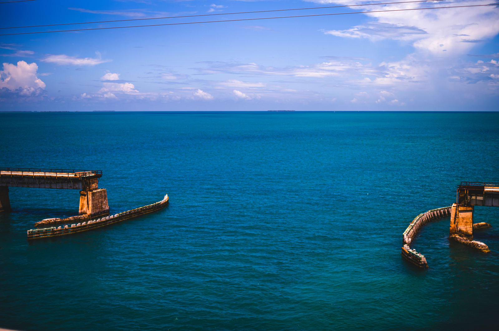
It's possible that referring to Okeechobee as a "lake" at all is the original flaw. The reality is a shallow, managed water system for the state that happens to have a channel. The numbers that matter to you are the channel depths - which on their best days annually are often only 6-8ft.
If that sounds like plenty of room to you, I suspect you're either in a bass boat, otherwise extremely shallow draft vessel, or are about to learn one very unique lesson you wish you hadn't. If you're looking to cut across the state of Florida in your boat - the Okeechobee Waterway is your one and only option.
The alternative is a much longer adventure - around Southwest Florida's Everglades. Practically void of services, infrastructure and most importantly - deep water. Except for a few well known stops, the longer passage rewards something Hemingway and Harry Truman would be proud of - your very own boating adventure in Florida's Keys.
These two paths are about as unique and different from one another as you could draw up. Because they are so unique, we will dive in one at a time - beginning with the notorious not-lake that has been moving people over the water through central Florida since the late 1800's.
Okeechobee waterway - history and construction
The U.S. Army Corps of Engineers was not necessarily considering recreational boating drafts when the series of locks and dams went up during the 1930's construction era.
Florida's one and only navigable cross-state canal opened in 1937 as the 154nm waterway you know today. Before any of that work was ever considered, the land use was purely Agricultural in the late 1800's. As water needs grew, this eventually pushed state planners to convert the "useless" Everglades into even more fertile farmland. The infrastructure was temporary at best, as proven by two rounds of devastating storms.
After the intense hurricanes in the 1926 and 1928 seasons breached and severely damaged the mud dikes that were already aging at the time, a wall of water flooded local communities - killing more than 2,500 people in one 1928 disaster alone.
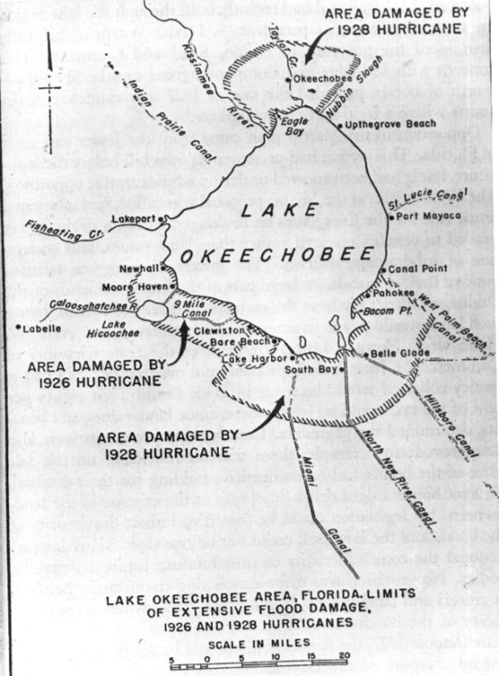
The response was federal and all encompassing. The U.S. Army Corps of engineers would launch into construction of the Herbert Hoover Dike - a massive containment levee devised to protect life and property. Additionally, the Corps formalized a cross-state channel in hopes of boosting the economy with this first of its kind Florida waterway.
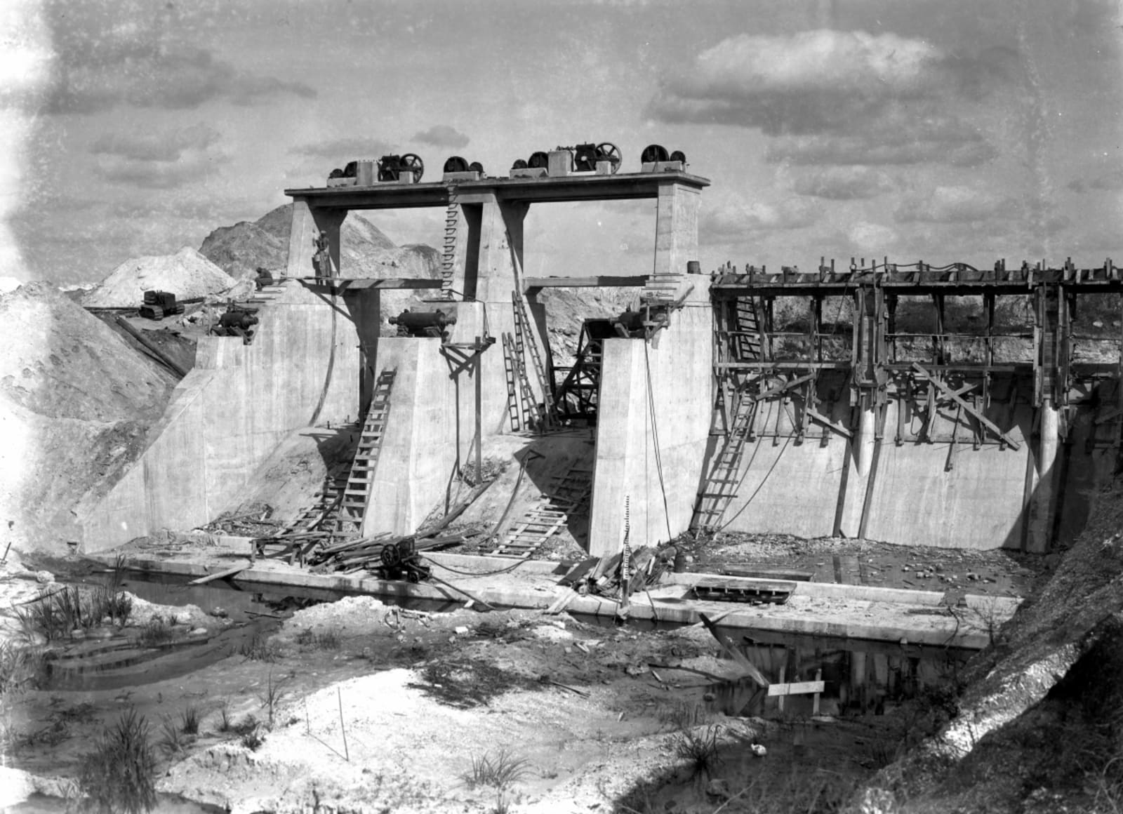
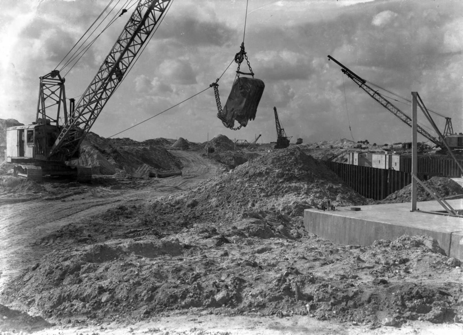
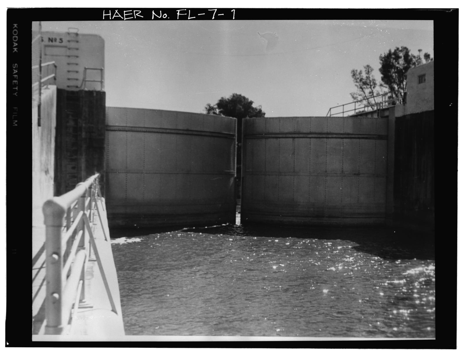
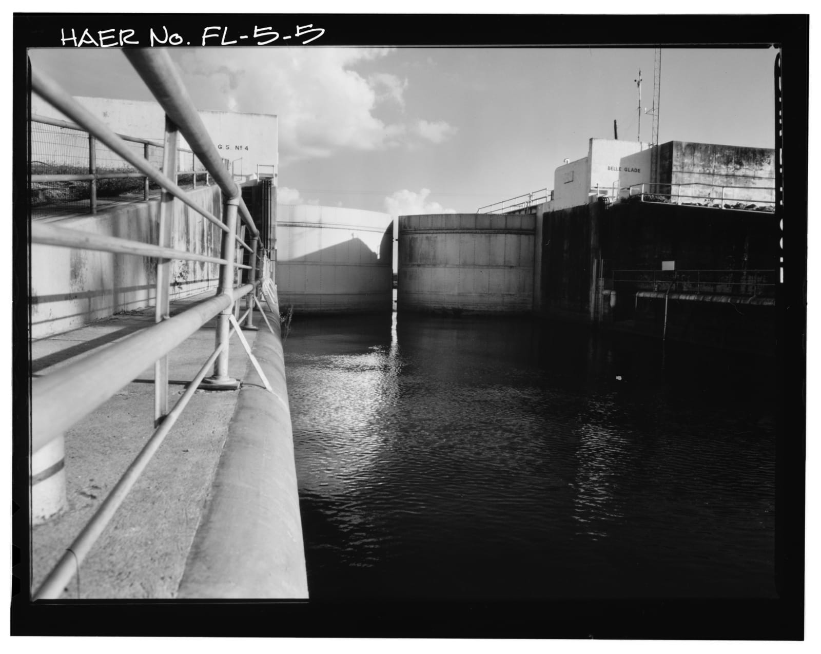
These remarkable survey photographs from 1937 show the Okeechobee Waterway construction by the U.S. Army Corps of Engineers.
Credit: US Library of Congress // State Archives of Florida (Florida Memory Collection)Just after completion, the system went into immediate use. During WWII, while the waterway was far too shallow for warships - it was perfect for shepherding commercial goods and smaller military patrol boats across the state, keeping them far from the U-Boat infested waters of the Keys.
why so shallow?
Lake Okeechobee is part of a managed water system built for flood protection, water supply, habitat and to maintain water quality and navigation. If your boat is drawing more than 3-5 ft, it's time to have a serious talk about how it most likely doesn't belong in the Okeechobee conversation.
From 2000-2003, the South Florida Water Management District performed a feasibility study on sediment management. While this wasn't a proposal to deepen the navigable channel, it was instead a research project to determine what impact dredging would have on the phosphorus laden bottom and what impacts that would have on overall water quality. The findings released in that report give a clear answer to why you can't just dredge a deeper channel: exorbitant cost.
It was estimated to cost $3 billion dollars and take some fifteen years - running eight dredging rigs 24 hours a day, seven days a week to complete. The kicker was the 30-50% chance of "uncertainty range" attached to the modeling and planning estimates. No wonder the idea was such a non-starter from the jump.
Unfortunately, any attempts at dredging would leave behind a perpetual 6-8cm of sediment across the open-water portion of the lake. Because of the lakes open nature and overall size, that sediment would essentially never settle, particularly over a fifteen year construction period. It's safe to say this body of water is not likely to get deeper in our lifetimes.
What you're left with is a route whose reported depth changes constantly with conditions and which simply must be checked close to departure time to have any real bearing on a travel decision. The channel has 6-8ft. on the best days when rainwater is cooperating and you've timed it right among the annual seasonal shifts.
If you were to mistakenly cross during a dry season or in the midst of any sort of low level year, not much can properly prepare you for the sounds your boat will make when striking the bottom.
Air draft is not a number one you're going to need to worry about on this waterway. The South Central Florida Express Railroad lift bridge is the only height restriction and it's left in the raised position until trains need to pass. You'll find 49ft. of vertical clearance on Okeechobee's Eastern side, according to the NOAA Coast Pilot measurements.
seasonal water levels are everything - except guaranteed
For boats that do fit, the Okeechobee Waterway has its own smaller fork in the road. The first route, Route 1, is the direct one (and only one you really need to concern yourself with). From Clewiston on the West, you head out and pass through Rocky Reef before turning towards the marked channel heading Northeast across open Lake Okeechobee. Port Mayaca on the East side of the lake awaits. The Corps calls it the open-lake route and puts Moore Haven to Port Mayaca to at 39 miles.
There is an official Route 2 - the long way around the lake's Southern edge. It follows the Rim Canal toward Clewiston rather than crossing the open water. This is not one any liveaboard, looper or snowbird is likely to run as there is in fact - even less water here than the open lake crossing (hovering between 4-6 ft.).
At time of publishing - on the Corps report ending August 2, 2026, Route 1's reported navigation depth was 4.83 feet and Route 2's was 3.03 feet. I suppose if you wanted to walk across the route, August is your ticket!
While Florida's annual rainy season begins in mid-May, the lake reacts much slower and is largely held up by the Kissimmee Basin bottleneck taking weeks for water to flow from that river basin South into the lake.
the 2026 report - waiting on the rainy season
On August 2, Lake Okeechobee stood at 10.89 feet NGVD. The Corps' period-of-record average for that date is 13.79 feet, which put the lake 2.90 feet below that reference. On the same date a year earlier, the lake was 12.04 feet; two years earlier, 13.57 feet. The Corps has the lake in its Water Shortage Management Band.
That is low, even for a lake with known seasonal changes. In the usual South Florida pattern, lake levels recede through the dry season, reach their lower period around May and June, then rise during the wet season toward higher water in late fall and winter. These depth changes matter deeply to Great Loop timing. A traditional Southbound crew reaching Florida after the wet season has had more chance to find the lake replenished than a boat looking at it in late spring.
This year has refused the tidy version of that story. The Corps said in July that the 2026 wet season began May 15, but below-average winter and spring rainfall had left drought conditions and summer rain had not produced significant recovery. Its stated objective is to recover Lake Okeechobee to between 14.5 and 15.5 feet NGVD by the end of the wet season.
The rest of the waterway remains a passage through managed water rather than a blank line across the middle of Florida. Coast Pilot 4 traces roughly 155 miles from the Atlantic Waterway near Stuart, through the St. Lucie River and Canal, across the lake, then down the Caloosahatchee system to the Gulf. The Corps operates five locks along the way. Its posted schedule is 7 a.m. to 5 p.m., with the final lockage beginning at 4:30 p.m., unless a current notice says otherwise.
Florida's best waits just around the bend - boating to the keys
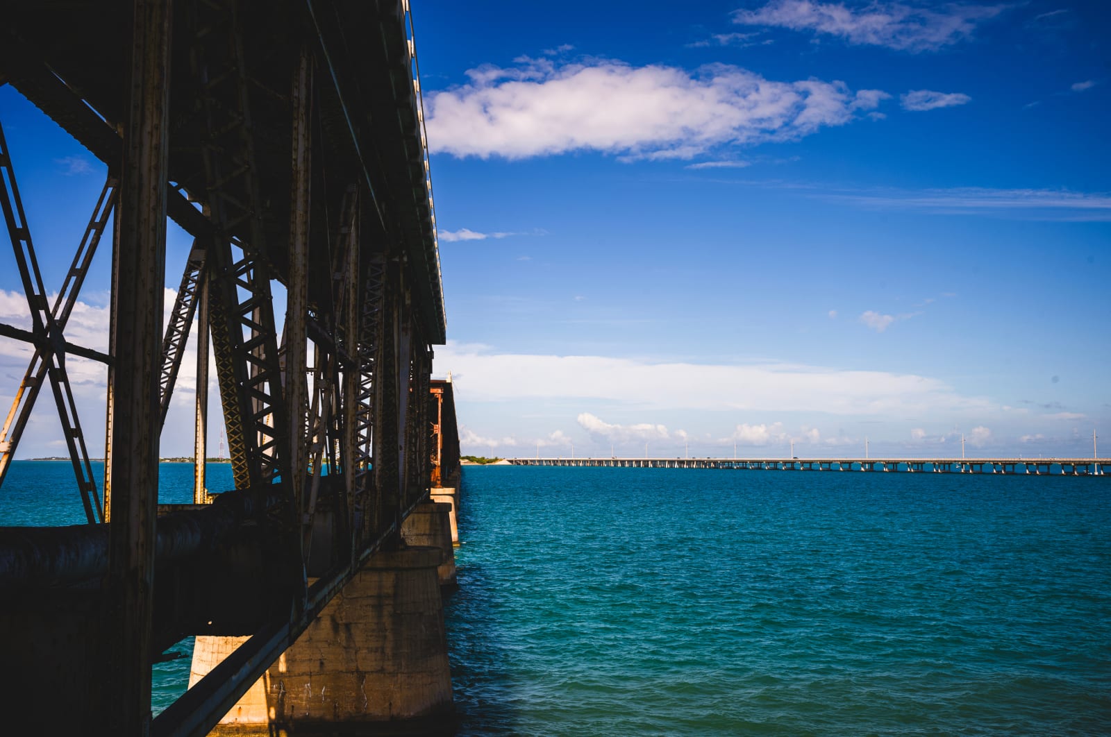
If the lack of water across Okeechobee diverts you further south, the alternative is one of longer days, coastal legs and visibility into a part of Florida's coast not many can say they've explored.
If you've just arrived in Tarpon Springs from your Gulf crossing, make your way to a Ft. Myers area marina of choice to begin the long southern trip. The Gulf ICW will get you as far as San Carlos Bay, at the mouth of the Caloosahatchee River. Welcome to the Ft. Myers end of your Keys jump runway.
From here, the protected segments of the route come to an end and you're now "outside" in the gulf, back in open water. Naples is the next logical stop on your way south, entering through Gordon Pass - a well marked and dredged channel leading into Naples bay.
As you look even further South on the map, it would appear on first glance you might be able to work your way down Florida's Southwest coast with stops at Marco Island, Cape Romano or Everglades City. In reality, the depth will again become a major issue in these waters (often as low as 4ft) - heavily favoring local knowledge and most likely far to slim a margin competing with your draft depth to consider.
The reality of venturing further South than Naples for a trawler style cruising trip is the full commitment. For the clearest deep water passage making, you'll aim directly at Key West. There are routes through Florida Bay and Moser Channel, but there is no simple, reliably deep shortcut that can be presented as a strong answer for a boat with a 3-5ft draft.
Entering Key West from the Gulf from the Northwest channel is the most straightforward deeper-water gateway to the ocean side of the Keys. The former richest city in the country is waiting for your arrival if you're up for a 11-14 hour long roughly 96nm passage to get there. If you can make it to 9 or 10 knots, this is a conceivable daytime run. At 7 knots, winter daylight become part of the math.
It's important to note that the Naples -> Key West direct route is not the only* option. Some Captains report Marco -> Everglades City -> Marathon variations through Florida Bay and Moser Channel. Those reports simply cannot be read as depth guarantee for another boat. While NOAA describes Moser Channel itself as 7-8ft. of water, the Florida Bay is shallow and irregular - with charted shoals, changing conditions and a much greater reliance on local expertise.
When you've had all you can stand of the Conch Republic, the journey North towards Miami follow Hawk Channel, the deeper through route inside the Florida Reefs and outside the Keys. NOAA gives the channel about 127 nautical miles from Key West to Cap Florida with charted depths between 9-34 feet through the channel.
While this is not an open Atlantic passage, it is exposed water with weather, reef openings and currents still very much taking your attention at the helm station.
For a 3-5ft draft boat, Passage North provides a number of reasonable travel days:
- Key West to Marathon // Boot Key Harbor = 42nm
- Marathon to Islamorada // Matecumbe area = 29nm
- Islamorada to Key Largo // Tavernier = 18-25nm
- Key Largo to Biscayne Bay // Miami = 45-60nm
For a crew on the Loop, this can be the chapter you've been looking forward to since the first map came out on the galley table. For Gold Loopers headed out again because boat life has a way of reopening old questions, it can be the reason to make the loop around the bend even when there is no longer a need to complete anything.
There is a cost to this alternative passage. The longer route expands the number of weather days, the number of stops and the number of chances for a compact plan to become an argument with reality. A crew with repairs behind it, a date ahead of it, or a boat that prefers smaller weather windows may regard the Okeechobee Waterway as a welcome piece of efficiency. Another crew may have the time and the appetite for the Keys and see the extra distance as the Florida they came to find.
the miles that make the trip
Neither answer makes a better captain. The Loop is full of miles that seem urgent until a boat makes the decision for you, a lock goes offline, or a forecast shifts the weight of the day. The point is to see the decision clearly enough that neither route arrives later as a forced surprise.
The Florida decision therefore has an order to it. First, the boat's draft meets the current Lake Okeechobee report. If those numbers leave the waterway in the conversation, Route 1 is the direct, deeper-reported lake passage and Route 2 is the longer rim-canal, low draft alternative. Then come the schedule, lock operations, lake weather and the crew's desire for one kind of Florida or the other.
The final vote still belongs to the captain, the boat and the conditions that exist when the decision is made. The best captains never stop learning.
source desk //
- U.S. Army Corps of Engineers, Jacksonville District: Lake Okeechobee and Vicinity Report: August 2, 2026 lake elevation, period-of-record comparison, Water Shortage Management Band, current Route 1 and Route 2 navigation-depth figures, survey-basis notes, and current bridge-clearance figure.
- U.S. Army Corps of Engineers, Jacksonville District: Lake Okeechobee Elevation Levels, 2026: the 2026 daily elevation record used to place the August 2 level in the year's decline and early wet-season context.
- U.S. Army Corps of Engineers, Jacksonville District: continued water conservation operations during the 2026 wet season: May 15 wet-season start, drought context, lack of significant hydrologic recovery and the stated 14.5–15.5-foot end-of-wet-season objective.
- U.S. Army Corps of Engineers, Jacksonville District: Port Mayaca Lock and Dam: 39-mile Route 1 and 50-mile Route 2 distances from Port Mayaca to Moore Haven, lock operating hours and last-lockage time.
- NOAA U.S. Coast Pilot 4, Chapter 12: the 155-mile Okeechobee Waterway route, Route 1 and Route 2 descriptions, federal-project depths, Rocky Reef, Port Mayaca railroad lift-bridge clearance, locks and the waterway's continuation to the Gulf.
- NOAA U.S. Coast Pilot 4, Chapter 11: the Intracoastal route south through Florida Bay and the Keys.
- National Weather Service Key West: Coastal Marine Forecasts by Zone: Florida Bay, Hawk Channel, Straits of Florida and Gulf forecast-zone divisions.
- South Florida Water Management District: Lake Stage seasonal model: the broad historical pattern of wet-season highs and dry-season lows used for seasonal context.
- U.S. Coast Guard Navigation Center: Southeast District Local Notice to Mariners: current federal aids-to-navigation discrepancies and temporary marine-safety information.